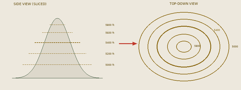
What Are Contour Lines?
Imagine slicing a mountain horizontally at regular height intervals, then looking straight down at those slices. Each ring becomes a contour line, a line connecting all points at the same elevation.
Three Things Every Contour Line Tells You
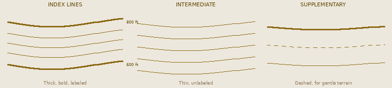
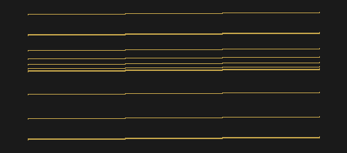
1. Elevation: Each line sits at a specific height above sea level. Index lines (the thicker, bolder ones) are labeled with their elevation.
2. Shape of the terrain: The curves and bends of contour lines mirror the shape of the land. Circular lines? A hill. Long parallel lines? A ridge.
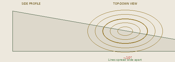
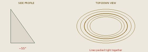
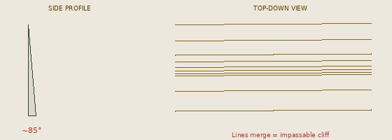
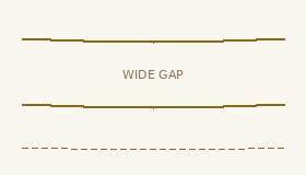
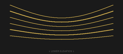
3. Steepness: This is the biggest unlock. Lines close together = steep terrain. Lines far apart = gentle slope. It’s that simple, and once you see it, you can’t unsee it.
02 // LINE TYPES
Know Your Lines
Reading Steepness
This is the single most useful skill in contour reading. Master this and you’ll know what the terrain feels like before you ever set foot on it.
Six Rules of Contour Lines
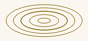
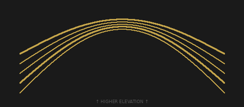
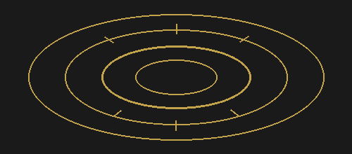
Closed Loops = Hilltop
Concentric closed contour lines indicate a summit or hilltop. The innermost ring is the highest point.
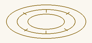
Tick Marks = Depression
Closed loops with small tick marks pointing inward mean the ground dips down: a crater, sinkhole, or depression, sinkhole, or depression.
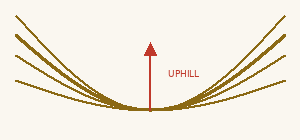
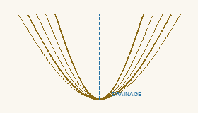
V’s Point Up = Valley
V-shaped contour lines pointing toward higher elevation indicate a valley or draw where water collects.
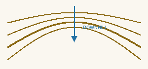
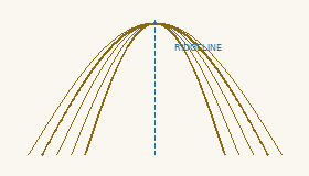
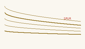
V’s Point Down = Ridge
V-shapes pointing toward lower elevation indicate a ridge or spur. High ground extending outward.
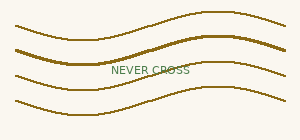
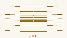
Lines Never Cross
Contour lines never intersect. One point can’t be two different elevations. If lines appear to touch, it’s a cliff.
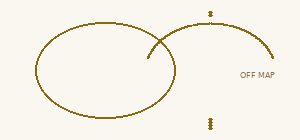
Lines Always Close
Every contour line forms a complete loop, even if it extends beyond the edge of your map.
Terrain Feature Glossary
Pro Tips
Reading Water
Water always flows perpendicular to contour lines, from high elevation to low. Find the V-shaped contour lines pointing uphill. That’s your drainage. A stream will run right down the center of that V. The tighter the V, the steeper and faster the water.
Estimating Trail Steepness
Count the contour lines your planned route crosses. Multiply by the contour interval. That’s your total elevation gain. A trail crossing 20 lines on a 40-foot interval map gains 800 feet. Divide gain by horizontal distance for average grade.
5% = easy trail | 10% = moderate | 15%+ = steep
Can You Read the Land?

What terrain feature do these contour lines represent?
A) Valley B) Hilltop / Summit C) Depression D) Saddle
REVEAL ANSWER
✓ B) Hilltop / Summit. Concentric closed contour lines with no tick marks = a hilltop. The innermost circle is the highest point.
The V-shapes point toward higher elevation. This is a:
A) Ridge / Spur B) Draw / Valley C) Cliff D) Flat area
REVEAL ANSWER
✓ B) Draw / Valley. V-shapes pointing uphill = a draw or valley. Water flows down from higher elevation through this channel.
The line spacing changes dramatically in the middle. What does this indicate?
A) A flat plateau B) A cliff or very steep face C) A river D) A hilltop
REVEAL ANSWER
✓ B) A cliff or very steep face. When contour lines merge into a dense band, that’s a cliff or extremely steep terrain.
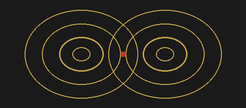
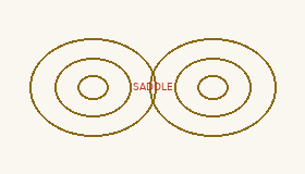
The red dot marks the low point between two peaks. This is called a:
A) Depression B) Draw C) Saddle / Col D) Bench
REVEAL ANSWER
✓ C) Saddle / Col. The low point on a ridge between two higher summits. Shaped like a horse saddle dipping between two highs.
Closed contour lines with tick marks pointing inward indicate:
A) A hilltop B) A depression / crater C) A saddle D) A plateau
REVEAL ANSWER
✓ B) A depression / crater. Tick marks (hachure marks) pointing inward = ground goes DOWN inside these rings, not up.
The V-shapes point DOWNHILL toward lower elevation. This is a:
A) Draw / Valley B) Ridge / Spur C) Depression D) Cliff
REVEAL ANSWER
✓ B) Ridge / Spur. V-shapes pointing downhill = a ridge or spur. High ground extending outward.
© Deviant Ink // Read the Land Guide